Sea Level Rise Map
QGIS
Cartography
Climate Modeling
Environmental Justice
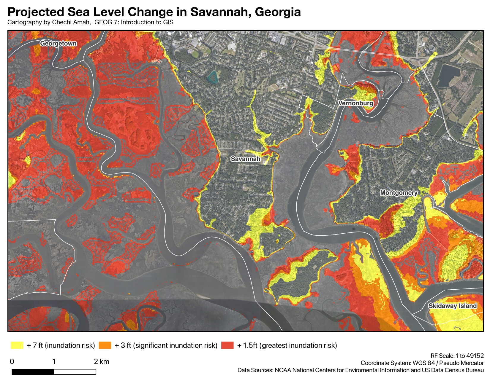
Using data from the National Oceanic and Atmospheric Administration: National Centers for Environmental Information and the US Census Bureau, this map analyzes the projected sea level rise in Savannah, GA by 2050.
The effects of climate change are rapidly intensifying. Coastal cities like Savannah, GA, are among the most at risk. This visualization helps identify vulnerable areas and communities that may be disproportionately affected by rising sea levels.
Data Sources: NOAA National Centers for Environmental Information, US Census Bureau